
Édition graphique en région Centre-Val-de-Loire
144 maisons d'éditions graphiques sont référencés sur la région Centre-Val-de-Loire
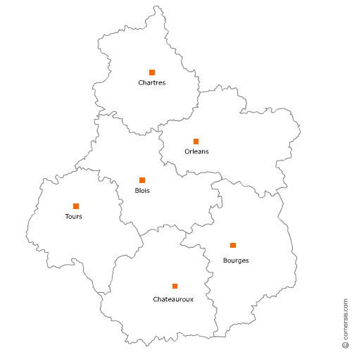
Vous recherchez une maison d'édition graphique en Centre-Val-de-Loire ?
La région Centre-Val-de-Loire représente 3% des maisons d'éditions graphiques de France.
C'est le département d'Indre-et-Loire qui compte le plus de maisons d'éditions graphiques en Centre-Val-de-Loire.
C'est le département d'Indre-et-Loire qui compte le plus de maisons d'éditions graphiques en Centre-Val-de-Loire.
Édition graphique dans le Cher (18)
Secteur de Bourges
Indice d'implantation
| Commune | Nb Pro | Habitants | Distance | |
|---|---|---|---|---|
| Bourges - 18000 | 6 | 67189 | 0,0 | km |
| Gardefort - 18300 | 1 | 146 | 38,9 | km |
| Villegenon - 18260 | 1 | 226 | 41,6 | km |
| Torteron - 18320 | 1 | 816 | 43,8 | km |
| Aubigny-sur-Nère - 18700 | 1 | 5582 | 45,6 | km |
Édition graphique dans l'Indre (36)
Secteur de Châteauroux
Indice d'implantation
| Commune | Nb Pro | Habitants | Distance | |
|---|---|---|---|---|
| Châteauroux - 36000 | 5 | 45209 | 0,0 | km |
| Saint-Maur - 36250 | 1 | 3531 | 4,5 | km |
| Orsennes - 36190 | 1 | 781 | 37,3 | km |
| Saint-Benoît-du-Sault - 36170 | 1 | 622 | 47,3 | km |
Secteur d'Issoudun
Indice d'implantation
| Commune | Nb Pro | Habitants | Distance | |
|---|---|---|---|---|
| Issoudun - 36100 | 1 | 12420 | 0,0 | km |
| Bommiers - 36120 | 1 | 297 | 17,0 | km |
| Saint-Christophe-en-Bazelle - 36210 | 1 | 395 | 34,4 | km |
Édition graphique en Indre-et-Loire (37)
Secteur de Tours
Indice d'implantation
| Commune | Nb Pro | Habitants | Distance | |
|---|---|---|---|---|
| Tours - 37000 | 7 | 134803 | 0,0 | km |
| la Riche - 37520 | 1 | 10276 | 1,4 | km |
| Saint-Cyr-sur-Loire - 37540 | 2 | 16239 | 1,8 | km |
| Saint-Pierre-des-Corps - 37700 | 1 | 15404 | 2,8 | km |
| Saint-Avertin - 37550 | 4 | 14893 | 4,5 | km |
| Joué-lès-Tours - 37300 | 5 | 37703 | 4,9 | km |
| Rochecorbon - 37210 | 1 | 3193 | 6,0 | km |
| Fondettes - 37230 | 1 | 10193 | 6,3 | km |
| Chambray-lès-Tours - 37170 | 4 | 10881 | 6,5 | km |
| Mettray - 37390 | 1 | 2065 | 7,2 | km |
| Notre-Dame-d'Oé - 37390 | 1 | 3929 | 7,4 | km |
| Ballan-Miré - 37510 | 1 | 7987 | 7,9 | km |
| Savonnières - 37510 | 1 | 3141 | 11,2 | km |
| Souvigné - 37330 | 1 | 815 | 25,9 | km |
Secteur de Loches
Indice d'implantation
| Commune | Nb Pro | Habitants | Distance | |
|---|---|---|---|---|
| Loches - 37600 | 3 | 6343 | 0,0 | km |
| Perrusson - 37600 | 1 | 1553 | 3,5 | km |
| Genillé - 37460 | 1 | 1591 | 9,9 | km |
| Manthelan - 37240 | 1 | 1419 | 15,4 | km |
Secteur de Monts
Indice d'implantation
| Commune | Nb Pro | Habitants | Distance | |
|---|---|---|---|---|
| Monts - 37260 | 2 | 7471 | 0,0 | km |
| Azay-le-Rideau - 37190 | 1 | 3414 | 12,1 | km |
| Vallères - 37190 | 1 | 1150 | 12,1 | km |
Secteur d'Amboise
Indice d'implantation
| Commune | Nb Pro | Habitants | Distance | |
|---|---|---|---|---|
| Amboise - 37400 | 0 | 13246 | 0,0 | km |
| Saint-Ouen-les-Vignes - 37530 | 1 | 1022 | 6,7 | km |
| Bléré - 37150 | 1 | 5268 | 9,1 | km |
| Dame-Marie-les-Bois - 37110 | 1 | 332 | 15,3 | km |
Secteur de Chinon
Indice d'implantation
| Commune | Nb Pro | Habitants | Distance | |
|---|---|---|---|---|
| Chinon - 37500 | 0 | 8044 | 0,0 | km |
| Saint-Benoît-la-Forêt - 37500 | 1 | 873 | 8,2 | km |
| Parçay-sur-Vienne - 37220 | 1 | 651 | 18,9 | km |
Secteur de Montlouis-sur-Loire
Indice d'implantation
| Commune | Nb Pro | Habitants | Distance | |
|---|---|---|---|---|
| Montlouis-sur-Loire - 37270 | 0 | 10787 | 0,0 | km |
| Vouvray - 37210 | 1 | 3068 | 3,7 | km |
| Monnaie - 37380 | 1 | 4206 | 13,4 | km |
Édition graphique dans le Loir-et-Cher (41)
Secteur de Blois
Indice d'implantation
| Commune | Nb Pro | Habitants | Distance | |
|---|---|---|---|---|
| Blois - 41000 | 6 | 45539 | 0,0 | km |
| Saint-Gervais-la-Forêt - 41350 | 2 | 3285 | 3,3 | km |
| la Chaussée-Saint-Victor - 41260 | 2 | 4468 | 4,3 | km |
| Noyers-sur-Cher - 41140 | 1 | 2773 | 35,1 | km |
Secteur de Mer
Indice d'implantation
| Commune | Nb Pro | Habitants | Distance | |
|---|---|---|---|---|
| Mer - 41500 | 1 | 6200 | 0,0 | km |
| Saint-Laurent-Nouan - 41220 | 1 | 4289 | 8,3 | km |
| Lamotte-Beuvron - 41600 | 1 | 4798 | 41,0 | km |
Édition graphique dans l'Eure-et-Loir (28)
Secteur de Chartres
Indice d'implantation
| Commune | Nb Pro | Habitants | Distance | |
|---|---|---|---|---|
| Chartres - 28000 | 2 | 38840 | 0,0 | km |
| Lucé - 28110 | 2 | 16149 | 2,1 | km |
| Luisant - 28600 | 3 | 6720 | 2,4 | km |
| Barjouville - 28630 | 1 | 1742 | 4,0 | km |
| Nogent-le-Phaye - 28630 | 1 | 1342 | 6,2 | km |
| Berchères-les-Pierres - 28630 | 1 | 991 | 8,1 | km |
| Meslay-le-Grenet - 28120 | 1 | 297 | 11,9 | km |
Secteur de Dreux
Indice d'implantation
| Commune | Nb Pro | Habitants | Distance | |
|---|---|---|---|---|
| Dreux - 28100 | 2 | 31373 | 0,0 | km |
| Saint-Rémy-sur-Avre - 28380 | 2 | 3831 | 10,0 | km |
Secteur de Nogent-le-Rotrou
Indice d'implantation
| Commune | Nb Pro | Habitants | Distance | |
|---|---|---|---|---|
| Nogent-le-Rotrou - 28400 | 0 | 10496 | 0,0 | km |
| Argenvilliers - 28480 | 1 | 353 | 12,1 | km |
| Authon-du-Perche - 28330 | 1 | 1 | 15,1 | km |
| Combres - 28480 | 1 | 546 | 18,1 | km |
| la Loupe - 28240 | 1 | 3530 | 22,2 | km |
Secteur de Châteaudun
Indice d'implantation
| Commune | Nb Pro | Habitants | Distance | |
|---|---|---|---|---|
| Châteaudun - 28200 | 0 | 13226 | 0,0 | km |
| Cloyes-sur-le-Loir - 28220 | 1 | 2762 | 11,0 | km |
| Brou - 28160 | 1 | 3447 | 19,7 | km |
Édition graphique dans le Loiret (45)
Secteur d'Orléans
Indice d'implantation
| Commune | Nb Pro | Habitants | Distance | |
|---|---|---|---|---|
| Orléans - 45000 | 7 | 114375 | 0,0 | km |
| Saint-Jean-de-la-Ruelle - 45140 | 1 | 16488 | 2,5 | km |
| Saint-Jean-le-Blanc - 45650 | 2 | 8104 | 2,5 | km |
| Fleury-les-Aubrais - 45400 | 4 | 20677 | 2,9 | km |
| Olivet - 45160 | 3 | 20458 | 4,5 | km |
| Saint-Denis-en-Val - 45560 | 1 | 7275 | 4,7 | km |
| Saran - 45770 | 1 | 15449 | 5,6 | km |
| Saint-Hilaire-Saint-Mesmin - 45160 | 3 | 2929 | 7,3 | km |
| Chécy - 45430 | 1 | 8756 | 8,9 | km |
| Saint-Cyr-en-Val - 45590 | 1 | 3192 | 9,3 | km |
| Mardié - 45430 | 1 | 2510 | 11,4 | km |
Secteur de Montargis
Indice d'implantation
| Commune | Nb Pro | Habitants | Distance | |
|---|---|---|---|---|
| Montargis - 45200 | 0 | 14326 | 0,0 | km |
| Châlette-sur-Loing - 45120 | 1 | 12812 | 1,7 | km |
| Villemandeur - 45700 | 3 | 6813 | 3,0 | km |
| Amilly - 45200 | 1 | 12232 | 3,1 | km |
| Lombreuil - 45700 | 1 | 298 | 10,6 | km |
| Château-Renard - 45220 | 1 | 2239 | 15,3 | km |
Secteur de Gien
Indice d'implantation
| Commune | Nb Pro | Habitants | Distance | |
|---|---|---|---|---|
| Gien - 45500 | 1 | 14624 | 0,0 | km |
| Poilly-lez-Gien - 45500 | 1 | 2383 | 2,8 | km |
| Nevoy - 45500 | 1 | 1178 | 4,2 | km |
| Briare - 45250 | 1 | 5748 | 9,8 | km |
| Châtillon-sur-Loire - 45360 | 1 | 3145 | 14,4 | km |
Secteur de Châteauneuf-sur-Loire
Indice d'implantation
| Commune | Nb Pro | Habitants | Distance | |
|---|---|---|---|---|
| Châteauneuf-sur-Loire - 45110 | 0 | 7906 | 0,0 | km |
| Saint-Martin-d'Abbat - 45110 | 1 | 1710 | 3,5 | km |
| Bray-en-Val - 45460 | 1 | 1393 | 11,4 | km |
Secteur de Pithiviers
Indice d'implantation
| Commune | Nb Pro | Habitants | Distance | |
|---|---|---|---|---|
| Pithiviers - 45300 | 1 | 9039 | 0,0 | km |