
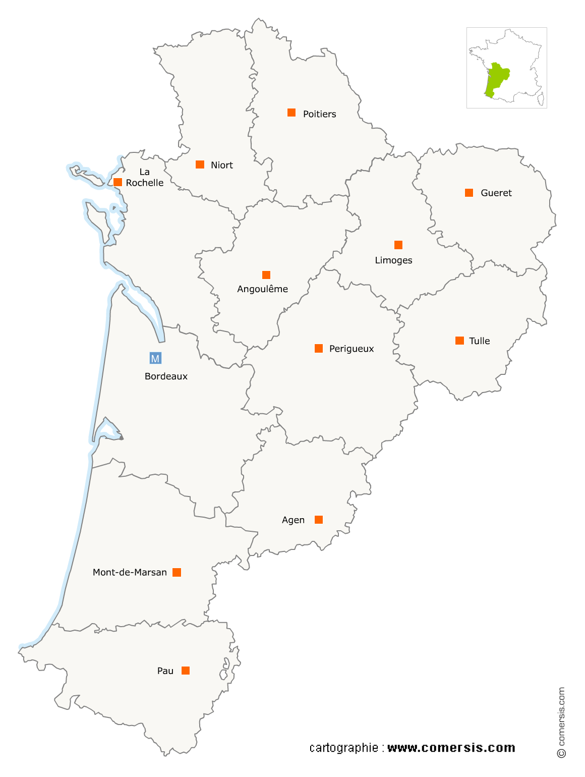
Édition graphique en région Nouvelle-Aquitaine
354 maisons d'éditions graphiques sont référencés sur la région Nouvelle-Aquitaine
Vous recherchez une maison d'édition graphique en Nouvelle-Aquitaine ?
La région Nouvelle-Aquitaine représente 8% des maisons d'éditions graphiques de France.
C'est le département de Gironde qui compte le plus de maisons d'éditions graphiques en Nouvelle-Aquitaine.
C'est le département de Gironde qui compte le plus de maisons d'éditions graphiques en Nouvelle-Aquitaine.
Édition graphique dans le Lot-et-Garonne (47)
Secteur de Marmande
Indice d'implantation
| Commune | Nb Pro | Habitants | Distance | |
|---|---|---|---|---|
| Marmande - 47200 | 2 | 18028 | 0,0 | km |
| Tonneins - 47400 | 1 | 8914 | 17,1 | km |
| Villeneuve-de-Duras - 47120 | 6 | 313 | 27,3 | km |
| Montaut - 47210 | 1 | 235 | 42,0 | km |
Secteur d'Agen
Indice d'implantation
| Commune | Nb Pro | Habitants | Distance | |
|---|---|---|---|---|
| Agen - 47000 | 1 | 34344 | 0,0 | km |
| Boé - 47550 | 2 | 5486 | 6,2 | km |
| Laplume - 47310 | 1 | 1446 | 12,8 | km |
| Saint-Nicolas-de-la-Balerme - 47220 | 1 | 386 | 13,8 | km |
| le Temple-sur-Lot - 47110 | 1 | 1001 | 20,5 | km |
| Castelmoron-sur-Lot - 47260 | 1 | 1709 | 23,4 | km |
| Anthé - 47370 | 1 | 197 | 32,6 | km |
Édition graphique dans les Deux-Sèvres (79)
Secteur de Niort
Indice d'implantation
| Commune | Nb Pro | Habitants | Distance | |
|---|---|---|---|---|
| Niort - 79000 | 4 | 57393 | 0,0 | km |
| Magné - 79460 | 1 | 2680 | 6,4 | km |
| Vouillé - 79230 | 1 | 3247 | 7,3 | km |
| Chauray - 79180 | 1 | 6655 | 7,7 | km |
| Coulon - 79510 | 1 | 2244 | 9,5 | km |
| Germond-Rouvre - 79220 | 1 | 1170 | 14,9 | km |
| Sainte-Soline - 79120 | 1 | 344 | 39,5 | km |
Secteur de Bressuire
Indice d'implantation
| Commune | Nb Pro | Habitants | Distance | |
|---|---|---|---|---|
| Bressuire - 79300 | 3 | 18962 | 0,0 | km |
| Courlay - 79440 | 1 | 2444 | 9,0 | km |
| Nueil-les-Aubiers - 79250 | 1 | 5632 | 13,3 | km |
| Mauléon - 79700 | 1 | 8414 | 22,4 | km |
| Thouars - 79100 | 1 | 14 | 26,2 | km |
Secteur de Parthenay
Indice d'implantation
| Commune | Nb Pro | Habitants | Distance | |
|---|---|---|---|---|
| Parthenay - 79200 | 3 | 10204 | 0,0 | km |
| Pompaire - 79200 | 3 | 2013 | 4,5 | km |
| Saint-Germain-de-Longue-Chaume - 79200 | 1 | 413 | 10,9 | km |
Édition graphique en Charente (16)
Secteur d'Angoulême
Indice d'implantation
| Commune | Nb Pro | Habitants | Distance | |
|---|---|---|---|---|
| Angoulême - 16000 | 9 | 41970 | 0,0 | km |
| Gond-Pontouvre - 16160 | 1 | 5883 | 1,8 | km |
| Saint-Yrieix-sur-Charente - 16710 | 1 | 7167 | 2,7 | km |
| l'Isle-d'Espagnac - 16340 | 1 | 5291 | 3,3 | km |
| Verteuil-sur-Charente - 16510 | 1 | 614 | 37,1 | km |
| Rioux-Martin - 16210 | 1 | 238 | 46,6 | km |
Secteur de Cognac
Indice d'implantation
| Commune | Nb Pro | Habitants | Distance | |
|---|---|---|---|---|
| Cognac - 16100 | 3 | 18705 | 0,0 | km |
| Châteaubernard - 16100 | 2 | 3605 | 2,6 | km |
| Nercillac - 16200 | 1 | 1066 | 6,5 | km |
| Jarnac - 16200 | 1 | 4449 | 11,7 | km |
| Salles-de-Barbezieux - 16300 | 1 | 450 | 31,1 | km |
Édition graphique dans les Pyrénées-Atlantiques (64)
Secteur de Bayonne
Indice d'implantation
| Commune | Nb Pro | Habitants | Distance | |
|---|---|---|---|---|
| Bayonne - 64100 | 8 | 47492 | 0,0 | km |
| Anglet - 64600 | 8 | 39184 | 3,0 | km |
| Biarritz - 64200 | 5 | 24993 | 6,5 | km |
| Arcangues - 64200 | 1 | 3141 | 7,0 | km |
| Guéthary - 64210 | 1 | 1281 | 12,7 | km |
| Urt - 64240 | 1 | 2218 | 15,1 | km |
| Espelette - 64250 | 1 | 2070 | 16,8 | km |
| Saint-Jean-de-Luz - 64500 | 2 | 12967 | 18,1 | km |
| Hasparren - 64240 | 1 | 6230 | 18,2 | km |
| Ainhoa - 64250 | 1 | 666 | 20,5 | km |
| Urrugne - 64122 | 1 | 9316 | 22,8 | km |
| Saint-Martin-d'Arrossa - 64780 | 1 | 523 | 31,2 | km |
| Gabat - 64120 | 1 | 231 | 38,2 | km |
Secteur de Pau
Indice d'implantation
| Commune | Nb Pro | Habitants | Distance | |
|---|---|---|---|---|
| Pau - 64000 | 7 | 77575 | 0,0 | km |
| Bizanos - 64320 | 2 | 4754 | 2,0 | km |
| Jurançon - 64110 | 1 | 7094 | 2,4 | km |
| Lons - 64140 | 2 | 12106 | 3,7 | km |
| Gan - 64290 | 1 | 5535 | 8,4 | km |
| Montardon - 64121 | 1 | 2305 | 8,4 | km |
| Serres-Morlaàs - 64160 | 1 | 750 | 9,4 | km |
| Serres-Castet - 64121 | 1 | 3973 | 9,5 | km |
| Coarraze - 64800 | 1 | 2143 | 18,4 | km |
Secteur d'Oloron-Sainte-Marie
Indice d'implantation
| Commune | Nb Pro | Habitants | Distance | |
|---|---|---|---|---|
| Oloron-Sainte-Marie - 64400 | 1 | 10794 | 0,0 | km |
| Lanne-en-Barétous - 64570 | 1 | 486 | 15,0 | km |
Secteur d'Orthez
Indice d'implantation
| Commune | Nb Pro | Habitants | Distance | |
|---|---|---|---|---|
| Orthez - 64300 | 0 | 10569 | 0,0 | km |
| Arthez-de-Béarn - 64370 | 1 | 1839 | 13,0 | km |
| Mourenx - 64150 | 1 | 6770 | 17,7 | km |
Édition graphique en Charente-Maritime (17)
Secteur de Rochelle
Indice d'implantation
| Commune | Nb Pro | Habitants | Distance | |
|---|---|---|---|---|
| la Rochelle - 17000 | 7 | 74344 | 0,0 | km |
| Lagord - 17140 | 2 | 7256 | 3,2 | km |
| Aytré - 17440 | 2 | 8844 | 4,3 | km |
| Sainte-Marie-de-Ré - 17740 | 1 | 3323 | 12,4 | km |
Secteur de Saintes
Indice d'implantation
| Commune | Nb Pro | Habitants | Distance | |
|---|---|---|---|---|
| Saintes - 17100 | 5 | 25601 | 0,0 | km |
| Mazerolles - 17800 | 1 | 247 | 22,5 | km |
Secteur de Rochefort
Indice d'implantation
| Commune | Nb Pro | Habitants | Distance | |
|---|---|---|---|---|
| Rochefort - 17300 | 2 | 24761 | 0,0 | km |
| Lussant - 17430 | 1 | 982 | 11,1 | km |
Secteur de Royan
Indice d'implantation
| Commune | Nb Pro | Habitants | Distance | |
|---|---|---|---|---|
| Royan - 17200 | 2 | 18138 | 0,0 | km |
| Vaux-sur-Mer - 17640 | 1 | 3856 | 3,3 | km |
Secteur de Saint-Pierre-d'Oléron
Indice d'implantation
| Commune | Nb Pro | Habitants | Distance | |
|---|---|---|---|---|
| Saint-Pierre-d'Oléron - 17310 | 2 | 6637 | 0,0 | km |
| le Château-d'Oléron - 17480 | 1 | 4005 | 10,5 | km |
Secteur de Saint-Jean-d'Angély
Indice d'implantation
| Commune | Nb Pro | Habitants | Distance | |
|---|---|---|---|---|
| Saint-Jean-d'Angély - 17400 | 1 | 7295 | 0,0 | km |
| Taillebourg - 17350 | 1 | 744 | 15,5 | km |
Secteur de Surgères
Indice d'implantation
| Commune | Nb Pro | Habitants | Distance | |
|---|---|---|---|---|
| Surgères - 17700 | 0 | 6647 | 0,0 | km |
| Chambon - 17290 | 1 | 882 | 7,8 | km |
| Ardillières - 17290 | 1 | 824 | 12,0 | km |
Édition graphique en Gironde (33)
Secteur de Bordeaux
Indice d'implantation
| Commune | Nb Pro | Habitants | Distance | |
|---|---|---|---|---|
| Bordeaux - 33000 | 36 | 243626 | 0,0 | km |
| le Bouscat - 33110 | 1 | 23207 | 2,9 | km |
| Cenon - 33150 | 4 | 22882 | 3,6 | km |
| Bègles - 33130 | 3 | 26104 | 4,5 | km |
| Lormont - 33310 | 3 | 20770 | 5,5 | km |
| Artigues-près-Bordeaux - 33370 | 2 | 7821 | 7,2 | km |
| Ambarès-et-Lagrave - 33440 | 1 | 14609 | 11,7 | km |
Secteur de Mérignac
Indice d'implantation
| Commune | Nb Pro | Habitants | Distance | |
|---|---|---|---|---|
| Mérignac - 33700 | 6 | 68386 | 0,0 | km |
| Pessac - 33600 | 4 | 60763 | 4,3 | km |
| le Haillan - 33185 | 1 | 9939 | 4,4 | km |
| Eysines - 33320 | 1 | 21762 | 4,6 | km |
| Bruges - 33520 | 1 | 16954 | 5,2 | km |
| Talence - 33400 | 2 | 41517 | 5,8 | km |
| Blanquefort - 33290 | 2 | 15297 | 7,6 | km |
| Saint-Médard-en-Jalles - 33160 | 3 | 29178 | 7,8 | km |
| Gradignan - 33170 | 1 | 24439 | 8,2 | km |
| Martignas-sur-Jalle - 33127 | 1 | 7355 | 10,2 | km |
| Villenave-d'Ornon - 33140 | 3 | 30663 | 11,3 | km |
Secteur de Langon
Indice d'implantation
| Commune | Nb Pro | Habitants | Distance | |
|---|---|---|---|---|
| Langon - 33210 | 2 | 7418 | 0,0 | km |
| Semens - 33490 | 1 | 190 | 7,0 | km |
| Sauternes - 33210 | 1 | 762 | 7,7 | km |
| Barie - 33190 | 1 | 286 | 10,9 | km |
| Bazas - 33430 | 1 | 4731 | 13,3 | km |
Secteur de Libourne
Indice d'implantation
| Commune | Nb Pro | Habitants | Distance | |
|---|---|---|---|---|
| Libourne - 33500 | 1 | 23947 | 0,0 | km |
| Saint-Émilion - 33330 | 1 | 1911 | 6,8 | km |
| Galgon - 33133 | 1 | 2998 | 8,6 | km |
| Saint-Quentin-de-Baron - 33750 | 1 | 2116 | 11,8 | km |
| Sainte-Foy-la-Grande - 33220 | 1 | 2321 | 36,8 | km |
Secteur de Saint-André-de-Cubzac
Indice d'implantation
| Commune | Nb Pro | Habitants | Distance | |
|---|---|---|---|---|
| Saint-André-de-Cubzac - 33240 | 0 | 10495 | 0,0 | km |
| Saint-Romain-la-Virvée - 33240 | 1 | 813 | 4,9 | km |
| Prignac-et-Marcamps - 33710 | 1 | 1394 | 5,8 | km |
| Pugnac - 33710 | 1 | 2243 | 10,9 | km |
| Pauillac - 33250 | 1 | 4986 | 33,0 | km |
| Saint-Seurin-de-Cadourne - 33180 | 1 | 711 | 42,2 | km |
Secteur d'Andernos-les-Bains
Indice d'implantation
| Commune | Nb Pro | Habitants | Distance | |
|---|---|---|---|---|
| Andernos-les-Bains - 33510 | 2 | 11575 | 0,0 | km |
| Audenge - 33980 | 1 | 6899 | 9,4 | km |
| Mios - 33380 | 1 | 8256 | 19,8 | km |
Secteur de Léognan
Indice d'implantation
| Commune | Nb Pro | Habitants | Distance | |
|---|---|---|---|---|
| Léognan - 33850 | 1 | 9749 | 0,0 | km |
| Martillac - 33650 | 1 | 2781 | 4,9 | km |
| la Brède - 33650 | 1 | 4054 | 7,7 | km |
| Latresne - 33360 | 1 | 3342 | 11,0 | km |
Secteur de Teste-de-Buch
Indice d'implantation
| Commune | Nb Pro | Habitants | Distance | |
|---|---|---|---|---|
| la Teste-de-Buch - 33260 | 2 | 25587 | 0,0 | km |
| Gujan-Mestras - 33470 | 1 | 20294 | 6,1 | km |
| le Teich - 33470 | 1 | 7155 | 9,6 | km |
Secteur de Cestas
Indice d'implantation
| Commune | Nb Pro | Habitants | Distance | |
|---|---|---|---|---|
| Cestas - 33610 | 2 | 16438 | 0,0 | km |
| Saint-Jean-d'Illac - 33127 | 1 | 7303 | 10,7 | km |
Secteur de Saint-Loubès
Indice d'implantation
| Commune | Nb Pro | Habitants | Distance | |
|---|---|---|---|---|
| Saint-Loubès - 33450 | 1 | 8467 | 0,0 | km |
| Pompignac - 33370 | 1 | 2838 | 7,4 | km |
Édition graphique en Corrèze (19)
Secteur de Brive-la-Gaillarde
Indice d'implantation
| Commune | Nb Pro | Habitants | Distance | |
|---|---|---|---|---|
| Brive-la-Gaillarde - 19100 | 6 | 46794 | 0,0 | km |
| Albignac - 19190 | 1 | 242 | 11,6 | km |
| Sadroc - 19270 | 1 | 857 | 14,0 | km |
| Beynat - 19190 | 1 | 1280 | 15,3 | km |
Secteur de Tulle
Indice d'implantation
| Commune | Nb Pro | Habitants | Distance | |
|---|---|---|---|---|
| Tulle - 19000 | 3 | 14323 | 0,0 | km |
| Chameyrat - 19330 | 1 | 1584 | 6,2 | km |
| le Chastang - 19190 | 1 | 372 | 10,4 | km |
| Saint-Sylvain - 19380 | 1 | 142 | 13,0 | km |
Édition graphique dans la Vienne (86)
Secteur de Poitiers
Indice d'implantation
| Commune | Nb Pro | Habitants | Distance | |
|---|---|---|---|---|
| Poitiers - 86000 | 5 | 87427 | 0,0 | km |
| Saint-Benoît - 86280 | 2 | 7096 | 3,8 | km |
| Montamisé - 86360 | 1 | 3516 | 7,5 | km |
| Chasseneuil-du-Poitou - 86360 | 1 | 4617 | 7,8 | km |
| Saint-Georges-lès-Baillargeaux - 86130 | 1 | 3997 | 10,4 | km |
| Cissé - 86170 | 1 | 2651 | 11,1 | km |
| Jaunay-Clan - 86130 | 1 | 5952 | 11,3 | km |
| Fleuré - 86340 | 1 | 1069 | 18,1 | km |
Secteur de Châtellerault
Indice d'implantation
| Commune | Nb Pro | Habitants | Distance | |
|---|---|---|---|---|
| Châtellerault - 86100 | 1 | 31262 | 0,0 | km |
| Scorbé-Clairvaux - 86140 | 1 | 2311 | 9,7 | km |
Secteur de Montmorillon
Indice d'implantation
| Commune | Nb Pro | Habitants | Distance | |
|---|---|---|---|---|
| Montmorillon - 86500 | 0 | 6197 | 0,0 | km |
| Béthines - 86310 | 1 | 476 | 15,7 | km |
Édition graphique dans la Creuse (23)
Secteur de Guéret
Indice d'implantation
| Commune | Nb Pro | Habitants | Distance | |
|---|---|---|---|---|
| Guéret - 23000 | 0 | 13143 | 0,0 | km |
| la Chapelle-Taillefert - 23000 | 2 | 398 | 8,1 | km |
Édition graphique en Haute-Vienne (87)
Secteur de Limoges
Indice d'implantation
| Commune | Nb Pro | Habitants | Distance | |
|---|---|---|---|---|
| Limoges - 87000 | 14 | 135098 | 0,0 | km |
| Panazol - 87350 | 1 | 10560 | 4,2 | km |
| Couzeix - 87270 | 2 | 8763 | 5,3 | km |
| Feytiat - 87220 | 2 | 6139 | 6,2 | km |
| Boisseuil - 87220 | 1 | 2822 | 8,9 | km |
| le Vigen - 87110 | 2 | 2068 | 9,2 | km |
| Verneuil-sur-Vienne - 87430 | 2 | 4637 | 10,4 | km |
| Saint-Priest-sous-Aixe - 87700 | 1 | 1656 | 12,4 | km |
| Compreignac - 87140 | 1 | 1784 | 17,8 | km |
| Rancon - 87290 | 1 | 522 | 33,8 | km |
Secteur de Saint-Junien
Indice d'implantation
| Commune | Nb Pro | Habitants | Distance | |
|---|---|---|---|---|
| Saint-Junien - 87200 | 2 | 11301 | 0,0 | km |
| Champsac - 87230 | 1 | 670 | 20,9 | km |
Secteur de Saint-Yrieix-la-Perche
Indice d'implantation
| Commune | Nb Pro | Habitants | Distance | |
|---|---|---|---|---|
| Saint-Yrieix-la-Perche - 87500 | 1 | 6922 | 0,0 | km |
| Saint-Priest-Ligoure - 87800 | 1 | 667 | 16,9 | km |
Édition graphique en Dordogne (24)
Secteur de Périgueux
Indice d'implantation
| Commune | Nb Pro | Habitants | Distance | |
|---|---|---|---|---|
| Périgueux - 24000 | 3 | 30036 | 0,0 | km |
| Boulazac - 24750 | 2 | 9697 | 4,4 | km |
| Agonac - 24460 | 1 | 1718 | 12,1 | km |
| Saint-Pierre-de-Chignac - 24330 | 1 | 860 | 12,7 | km |
Secteur de Bergerac
Indice d'implantation
| Commune | Nb Pro | Habitants | Distance | |
|---|---|---|---|---|
| Bergerac - 24100 | 2 | 28063 | 0,0 | km |
| Monbazillac - 24240 | 1 | 906 | 6,6 | km |
| Mauzac-et-Grand-Castang - 24150 | 1 | 894 | 24,6 | km |
| Beauronne - 24400 | 1 | 342 | 28,3 | km |
| Saint-Michel-de-Double - 24400 | 1 | 253 | 29,5 | km |
Secteur de Sarlat-la-Canéda
Indice d'implantation
| Commune | Nb Pro | Habitants | Distance | |
|---|---|---|---|---|
| Sarlat-la-Canéda - 24200 | 1 | 9259 | 0,0 | km |
| Saint-Julien-de-Lampon - 24370 | 1 | 622 | 12,0 | km |
| Carves - 24170 | 1 | 106 | 16,4 | km |
| Villefranche-du-Périgord - 24550 | 1 | 717 | 30,7 | km |
Secteur de Terrasson-Lavilledieu
Indice d'implantation
| Commune | Nb Pro | Habitants | Distance | |
|---|---|---|---|---|
| Terrasson-Lavilledieu - 24120 | 0 | 6212 | 0,0 | km |
| Hautefort - 24390 | 1 | 1038 | 18,6 | km |
Édition graphique dans les Landes (40)
Secteur de Dax
Indice d'implantation
| Commune | Nb Pro | Habitants | Distance | |
|---|---|---|---|---|
| Dax - 40100 | 1 | 20776 | 0,0 | km |
| Narrosse - 40180 | 1 | 3178 | 3,8 | km |
| Bélus - 40300 | 1 | 615 | 13,5 | km |
| Mugron - 40250 | 1 | 1439 | 24,9 | km |
| Gaujacq - 40330 | 1 | 445 | 26,5 | km |
| Lit-et-Mixe - 40170 | 1 | 1563 | 39,8 | km |
Secteur de Capbreton
Indice d'implantation
| Commune | Nb Pro | Habitants | Distance | |
|---|---|---|---|---|
| Capbreton - 40130 | 1 | 8396 | 0,0 | km |
| Angresse - 40150 | 1 | 1819 | 4,9 | km |
| Bénesse-Maremne - 40230 | 1 | 2624 | 5,6 | km |
| Labenne - 40530 | 1 | 5419 | 5,7 | km |
Secteur de Mont-de-Marsan
Indice d'implantation
| Commune | Nb Pro | Habitants | Distance | |
|---|---|---|---|---|
| Mont-de-Marsan - 40000 | 1 | 31334 | 0,0 | km |
| Benquet - 40280 | 1 | 1587 | 6,0 | km |
| Villeneuve-de-Marsan - 40190 | 1 | 2421 | 15,8 | km |
Secteur de Biscarrosse
Indice d'implantation
| Commune | Nb Pro | Habitants | Distance | |
|---|---|---|---|---|
| Biscarrosse - 40600 | 1 | 13983 | 0,0 | km |
Secteur de Tarnos
Indice d'implantation
| Commune | Nb Pro | Habitants | Distance | |
|---|---|---|---|---|
| Tarnos - 40220 | 1 | 12269 | 0,0 | km |